August 24, 2024
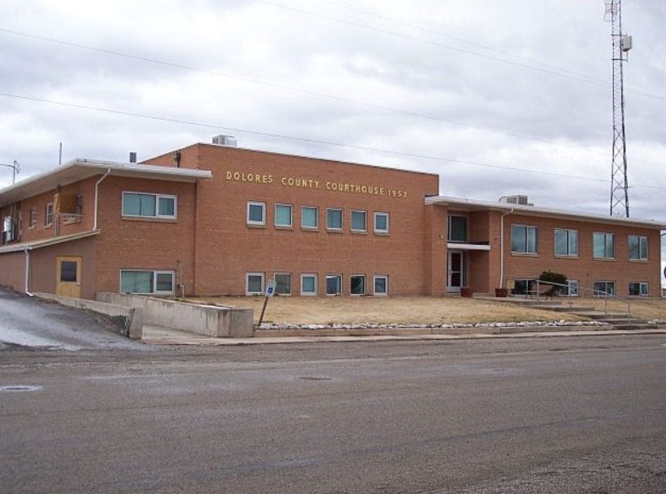
[The Dolores County Courthouse, Dolores County, CO.]
Boulder County, CO.
[The following is a press release from Boulder County, CO.]
Open House for the Boulder to Erie Regional Trail (BERT) Plan on August 29, 2024
The draft BERT Plan will be available for public comment September 3, 2024 –September 25, 2024
Key Points
Attend a Regional Trails Program open house for the BERT Plan on Thursday, August 29 from 5-7 p.m. at the Via Mobility Services Boulder Facility, 2855 63rd St.
This Plan evaluates options for the creation of a regional trail connection linking the City of Boulder and Town of Erie.
For more information, visit the project website or contact Tonya Luebbert, Regional Trails Planner, at tluebbert@bouldercounty.gov.
Boulder County, Colo. - Boulder County invites you to learn more about the draft Boulder to Erie Regional Trail (BERT) Plan at a public open house from 5-7 p.m. on Thursday, August 29 at the Via Mobility Services Boulder Facility, 2855 63rd St., Boulder.
In partnership with the City of Boulder and Town of Erie, Boulder County is evaluating options for the construction of a new regional trail connection linking Boulder and Erie. The first step in trail development is to conduct a planning process to identify needs, opportunities, and constraints of constructing the regional trail.
The planning process is now in its final stage of development and seeking feedback on a draft plan. At this open house, the team will share an overview of the project, the preferred alignment for further consideration, and opportunities to review and provide comments on the draft plan.
View more at boco.org/BERT, including upcoming board meetings in September and October. F
or more information, contact Tonya Luebbert, Regional Trails Planner, at tluebbert@bouldercounty.gov or 720-564-2866.
Colorado Flood Threat
[The following is a press release from the Colorado Water Conservation Board]
— A LOW flood threat has been issued for the Southwest Slope, San Juan Mountains and Central Mountains
— Fire-Burn Forecast Summary: 3 burn areas under LOW threat; click HERE for more information.
With just one more week left in August, the monsoon continues to hold strong thanks to broad southwesterly flow aloft ushering in subtropical moisture. A deep trough along the western U.S. coast is providing broad lift leading to pockets of clouds and showers pushing across western Colorado. One difference from yesterday is that water vapor imagery indicates a stripe of upper-level drying has entered far western Colorado this morning. As a result, Grand Junction’s PW value is at 1.06 inches, down 0.17 inches from yesterday morning’s reading. There’s still plenty of low-level moisture around with dew points in the 40s to 50s°F, so expect shower and thunderstorm coverage to increase over western Colorado this afternoon. Fast flow aloft at 30-40 knots will keep showers and storms on the move which helps keep the flooding threat low. A few gusty storms are possible this afternoon to evening as CAPE values may reach 750-1000 J/Kg in a few spots.
Over eastern Colorado, southwesterly surface winds are providing a downslope component which has already scoured out the early morning low cloud deck over the eastern Plains. Higher based clouds are streaming along the Front Range to Southeast Mountains. Inverted-V profiles are already evident over southeastern Colorado thanks to rapid heating and low-level moisture mixing out. So, showers and storms have the best chance to initiate over higher terrain this afternoon and move quickly northeast. Dry boundary layer conditions are likely to be prevalent over lower elevations. One exception to this is that deeper moisture is present over northeastern Colorado with PW values near 1.3 inches in the northeast corner. This area is likely to stay capped through this evening, but capable of supporting storms moving in from the southwest. Still, the main concern with today’s storms that pass over eastern Colorado is the potential for locally gusty winds due to supporting winds aloft.
Zone-Specific Forecasts:
Southwest Slope, San Juan Mountains & Central Mountains:
Widely scattered showers this morning increasing to numerous showers this afternoon. Isolated thunderstorms this morning increasing to scattered coverage this afternoon. Within thunderstorms, isolated maximum 1-hour rain rates of 1.25 inches are possible. Flooding threats such as excessive runoff, mud flows and debris slides on steep terrain, and flash flooding of small streams, creeks and low-lying roads are possible, and a LOW flood threat has been issued. Isolated storm-total rainfall amounts of 2.5 inches are possible where multiple rounds of rain track over the same areas.
Prime time: Ongoing to Midnight
Northwest Slope, Northern Mountains & Grand Valley:
Isolated showers and thunderstorms are possible this morning over the Grand Mesa, Flat Tops and Northern Mountains. Scattered showers and widely scattered thunderstorms are likely this afternoon over higher terrain. Isolated showers and thunderstorms may continue this evening. Scattered showers are likely after Midnight over the Northern Mountains and isolated showers are possible in western zones. Within thunderstorms, isolated maximum 1-hour rain rates of 0.75 inches are possible. Isolated storm-total rainfall amounts of 1.75 inches are possible where multiple rounds of rain track over the same areas. Flooding is NOT expected.
Prime time: Ongoing
San Luis Valley, Southeast Mountains, Raton Ridge, Southeast Plains & Palmer Ridge:
Scattered showers and thunderstorms are likely along the Sangre de Cristo and Wet Mountains. Widely scattered showers and thunderstorms are possible elsewhere. Within thunderstorms, isolated maximum 30-minute/1-hour rain rates of 0.50/0.75 inches are possible. Flooding is NOT expected.
Prime time: Noon to Midnight
Front Range, Urban Corridor & Northeast Plains:
Scattered showers and thunderstorms are likely along the Front Range. Widely scattered showers and thunderstorms are possible elsewhere. Within thunderstorms, isolated maximum 30-minute/1-hour rain rates of 0.60/0.80 inches are possible. Flooding is NOT expected.
Primetime: 1:00 PM to Midnight
Comics
Dry Bar Comedy
Bike locks should be illegal, Kellen Erskine
Resources
Until next time,


